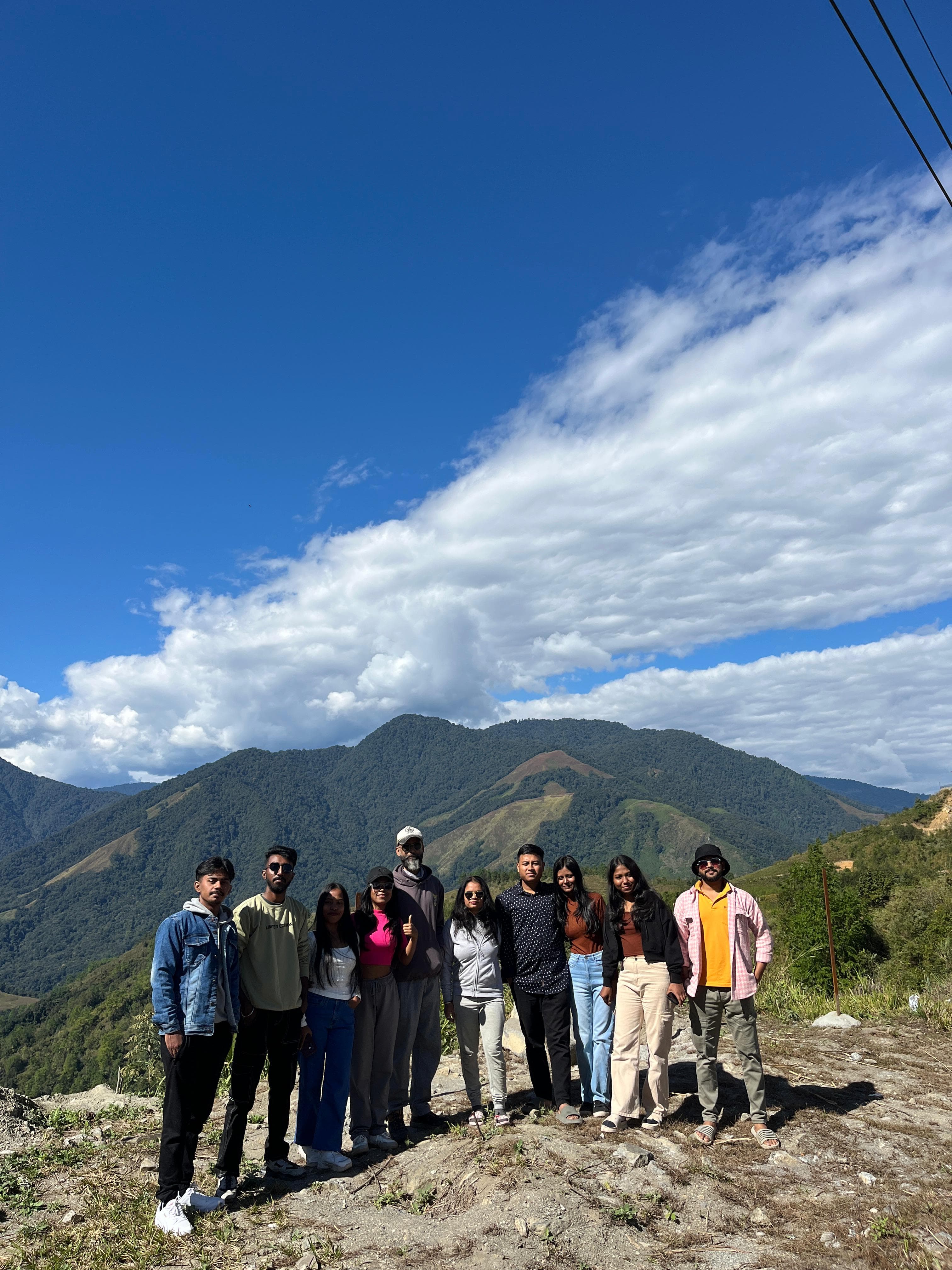
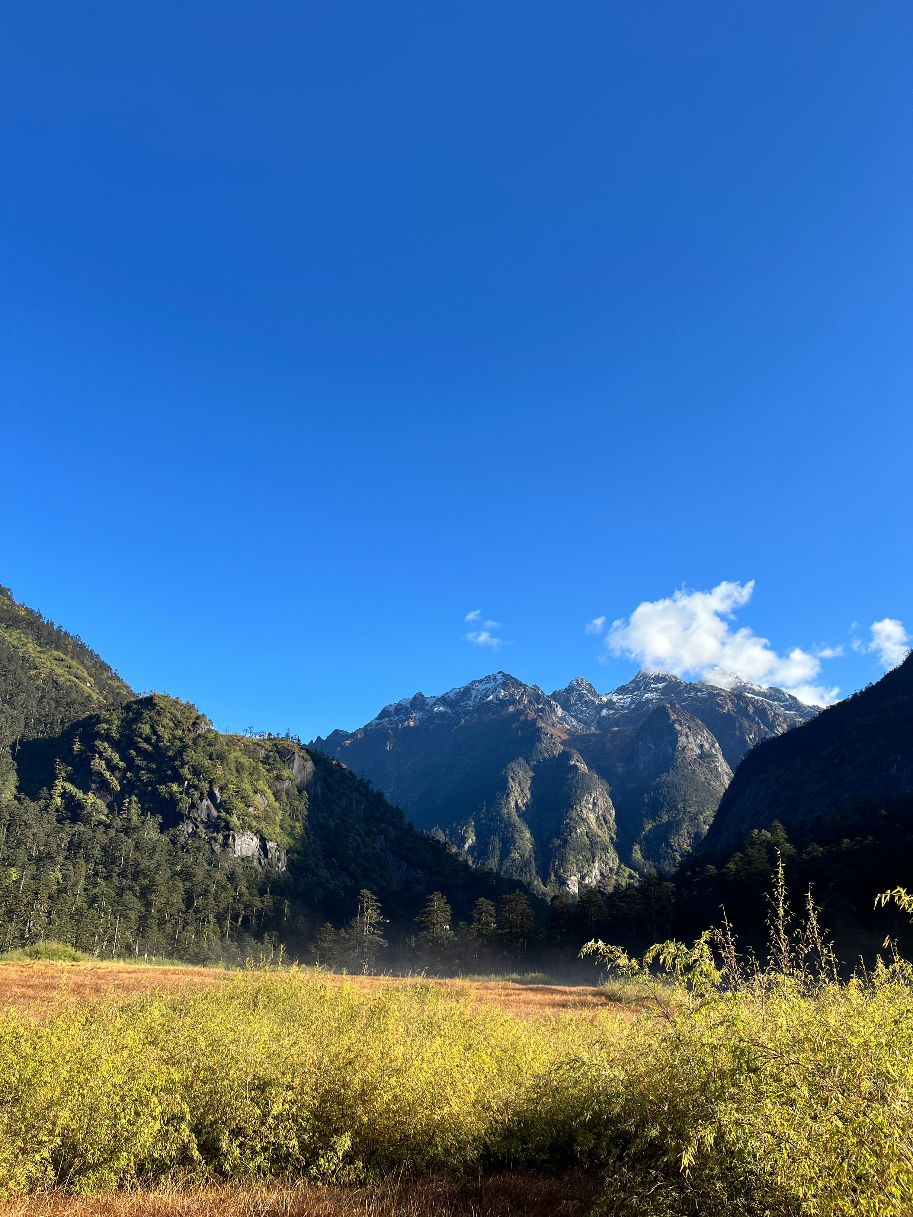
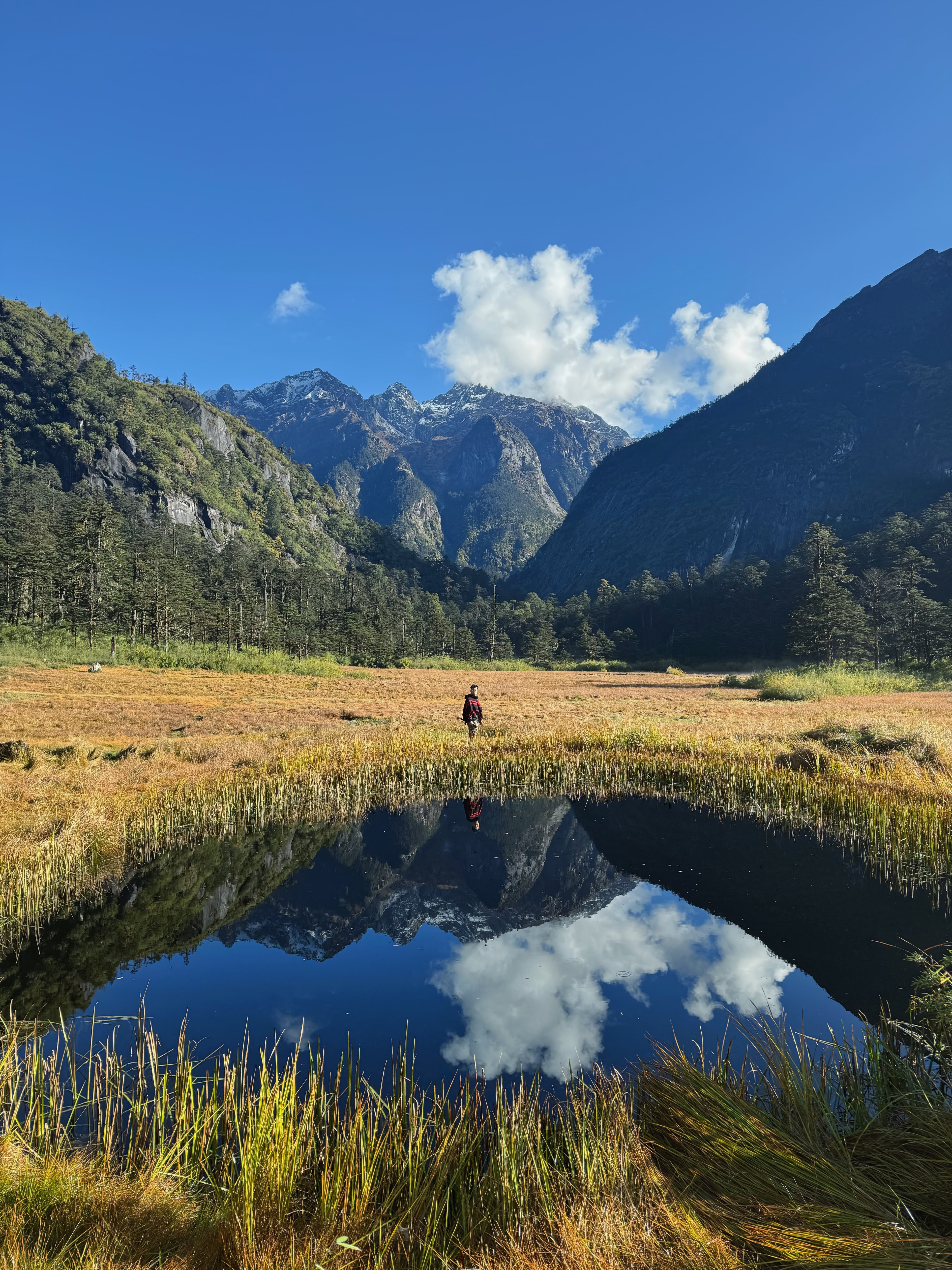
The rolling high grassland horizon at Pomo, above Anini in Dibang Valley

Dibrugarh · Mayodia · Anini · Pomo · Gipulin

The Pomo Grassland expedition

Six Daysin the Dibang

Five nights inside India's emptiest district, built around one twelve-hour morning: headlamps at 3 AM, alpine grassland by late morning, down before the light goes. The rest of the week is arranged to make that day possible.

6days
5 nights
385km
Dibrugarh to Anini
2,655m
Mayodia high point
03:00start
Pomo summit day
4–6pax
Group size

The whole week, in one screen

Six days, six frames

Before any of the detail: this is what the week actually looks like, in order, one photograph per day. Everything below is the long version of these six pictures.

  1. Cloud rolling across the ridgelines at Mayodia Pass on the road to Anini

    Day 1

    Into the high valley

    385 km and one mountain pass

  2. Waterfall dropping through forest in the valley below Anini

    Day 2

    Waterfall country

    Falls, the Dri, and a camp

  3. Wide open alpine grassland rolling to the horizon at Pomo, above Anini

    Day 3

    Pomo Grassland

    The trek. Twelve hours

  4. Montane forest and valley road in the Gipulin side valley near Anini

    Day 4

    Gipulin & the glass bridge

    A side valley and a glass floor

  5. High meadow light on the grasslands above Anini

    Day 5

    Emuli, Karu & the last fire

    High meadows, then a bonfire

  6. Mist moving through the mountains on the road down from Anini

    Day 6

    Down the mountain

    Down the mountain, home

6days
5 nights
385km
Dibrugarh to Anini
2,655m
Mayodia high point
03:00start
Pomo summit day
4–6pax
Group size

5 Nights / 6 Days · October – April

18,999per person

See what your party pays

The premise

Most people who reach Anini spend one night there and turn around. They see the pass, they photograph the plateau, and they drive back down having never met the country above the town.

This is the trip that goes above it. Six days built around a single hard morning — a 3 AM start onto Pomo grassland, twelve hours on foot, back before the light goes — with the rest of the week arranged around it like a properly planned expedition: two easing days before, two recovery days after, and every long drive taken in daylight.

You sleep five nights in Dibang Valley. One of them is in a camp on the river flats with no signal and no walls between you and the water. The other four are in Anini, in a homestay where dinner is whatever the kitchen is cooking and the last night ends at a bonfire.

This is

  • A real trek day — 12 hours, unsupported terrain, one shot at it
  • Five nights inside the valley, not two nights and a lot of driving
  • Small groups only: four to six people, one vehicle, one guide
  • Camp on the Dri flats, homestay in Anini, bonfire on the last night

This is not

  • A soft sightseeing loop — Day 3 will ask something of you
  • A hotel trip; Anini has homestays and camps, and that is the point
  • Weather-proof — Mayodia decides, and sometimes it decides against us
  • Bookable in monsoon. June to August we say no, and mean it

Day one, in metres

The climb

385 km from tea flats to plateau. The first 150 are flat and fast; everything after Roing is mountain.

2,655 m2,000 m1,000 mSea level
Elevation
2,655m
From Dibrugarh
206km

Mayodia Pass

The weather line. We cross before noon — afternoons belong to fog.

Day 1 of 6 · leaves 05:00 – 06:30

Into the high valleythe long day

From
Dibrugarh / Tinsukia
Sleeps
Anini
Cloud rolling across the ridgelines at Mayodia Pass on the road to Anini
Mayodia PassPlate 01

The one genuinely long day of the trip, taken deliberately at the front so everything after it is unhurried.

We leave in the dark because the arithmetic demands it: 385 kilometres, of which 235 are mountain, and a pass that closes itself in cloud most afternoons. Breakfast happens at a dhaba somewhere past the Bhupen Hazarika Setu. By late morning the road has stopped pretending to be flat, and by the time you reach Mayodia at 2,655 metres the temperature has dropped roughly twenty degrees from where you started.

Then it all falls away — Hunli, the slide corridor, Etalin for lunch — and the last hour opens onto the Anini plateau. Most guests go quiet here. We let them.

Mountain road cut into forested ridges on NH-313 below Anini
NH-31301
Deep forested valley seen from the Anini road
NH-31302
The high plateau at Anini between the Dri and Mathun rivers
Anini Plateau03
  1. Dr. Bhupen Hazarika Setu

    9.15 km over the Lohit — India's longest bridge

  2. Roing

    Fuel, permits checked, last dependable signal

  3. Mayodia Pass

    2,655 m · the route's high point and its weather line

  4. Etalin

    Lunch halt on the far side

Day 2 of 6 · leaves 08:00 – 09:00

Waterfall countrythe valley floor

From
Anini
Sleeps
Chigu Camp
Waterfall dropping through forest in the valley below Anini
Deccan FallsPlate 02

A full day spent on the valley floor, finishing at a camp on the river with nothing around it.

Dibang's water does the work today. The valley below Anini is stitched with falls — some roadside, some a short walk in — and the Dri runs through the middle of it in that particular glacial grey-green that photographs badly and looks extraordinary in person. We move slowly. This is the day that makes the trek day possible, because it puts a full day of altitude and walking in your legs without asking for anything hard.

You sleep at Chigu, on the flats, in a camp. No walls, no signal, and the river all night. Tomorrow starts at three.

Orchard and forest slopes near Dree Afra below Anini
Dree Afra01
Wide valley view from Mawuando near Anini
Mawuando02
The glacial grey-green Dri river running through the valley near Anini
Dri River03
  1. Dree Afra

    First stop out of Anini

  2. Mawuando

    Viewpoint over the valley

  3. The Dri

    The river that names the country

  4. Deccan · Ahi · Bruni

    Three falls, three moods

  5. Chigu Camp

    Overnight on the river flats

Wide open alpine grassland rolling to the horizon at Pomo, above Anini

Day 3 · 03:00 · Chigu Camp

twelve hours

Day 3 of 6 · leaves 03:00

Pomo Grassland

From
Chigu Camp
Sleeps
Anini

The reason the other five days exist. Headlamps at three, grassland by late morning, down before the light goes.

There is no way to make this day comfortable, so we make it early instead. You walk out of camp in the dark with a headlamp and a guide who has done this since he was a boy, and you climb through forest for the first several hours while the sky slowly stops being black. The tree line gives way to open slope, the slope gives way to grass, and then the horizon simply keeps going — rolling meadow in every direction with the Mishmi ridges stacked behind it.

You get a couple of hours up there. Then you turn around, because coming down takes as long as going up and nobody descends this in the dark. Back in Anini by evening, and dinner tastes better than it has any right to.

Rolling hills of the Pomo grassland under high cloud
Pomo Grassland01
The rolling high grassland horizon at Pomo with the Mishmi ridges behind
Pomo Grassland02
Alpine meadow and ridgeline light at Pomo, Dibang Valley
Pomo Grassland03
  1. 03:00 · Headlamps

    Out of Chigu on foot

  2. Forest section

    The long dark climb

  3. Tree line

    Where the sky opens

  4. Pomo Grassland

    Horizon country

  5. 15:00 · Down

    Trek closes, transfer to Anini

Day 4 of 6 · leaves Late start

Gipulin & the glass bridgethe easy day

From
Anini
Sleeps
Anini
Montane forest and valley road in the Gipulin side valley near Anini
GipulinPlate 04

Deliberately gentle. Legs are wrecked, so today happens mostly from a vehicle and on short walks.

Gipulin sits in a side valley that most itineraries never mention, and after yesterday it is exactly the right dose: a valley road, a waterfall at Matu you can walk to in minutes, and a glass-floored bridge slung over the gorge that is either the highlight of the day or the thing you refuse to step onto. Both reactions are common.

We keep the schedule loose. If the group wants to sit by the Matu for two hours instead of driving on, we sit by the Matu for two hours.

Cloud and ridgeline layered above Dibang Valley
Dibang Valley01
A cottage on the hillside at Anini in Dibang Valley
Anini02
Dense forest cover on the slopes of Dibang Valley
Dibang Valley03
  1. Matu Valley

    The side valley most trips skip

  2. Matu Waterfall

    Short walk in from the road

  3. The Glass Bridge

    Glass floor over the gorge

  4. Valley viewpoints

    Unhurried, weather permitting

Day 5 of 6 · leaves 09:00

Emuli, Karu & the last firethe high meadows

From
Anini
Sleeps
Anini
High meadow light on the grasslands above Anini
Pomo GrasslandPlate 05

Grassland again, but the kind you can drive to — and then a market walk and a bonfire to close the week.

Emuli and Karu are the meadows above Anini you can reach without a twelve-hour day. Wide, quiet, and best in the first hour of light or the last. We spend the morning and early afternoon up there, then drop back into town while the market is still open — which is the only honest way to meet Anini as a town rather than a viewpoint.

The last night is a bonfire at the homestay. Nobody has ever asked to go to bed early on this one.

Alpine meadow and ridgeline light at Pomo, Dibang Valley
Pomo Grassland01
Village hills and terraced slopes around Anini
Above Anini02
The high plateau at Anini between the Dri and Mathun rivers
Anini Plateau03
  1. Emuli Grassland

    Morning light on the meadows

  2. Karu Viewpoint

    The long look down the valley

  3. Karu Grassland

    Open country, gentle walking

  4. Anini Market

    Evening walk through town

  5. Bonfire

    Last night at the homestay

Day 6 of 6 · leaves 06:00 – 07:00

Down the mountainthe way back

From
Anini
Sleeps
Dibrugarh drop
Mist moving through the mountains on the road down from Anini
Hunli roadPlate 06

Out early via Hunli and Mayodia, over the long bridge, into Dibrugarh by evening.

The return runs the same road in reverse and it is a different road entirely — you know what the corners do now, and the pass that was a wall on day one is just weather on day six. We stop where you want to stop, because there is no arrival deadline other than getting off the mountain in daylight.

Drop-off in Dibrugarh between 17:00 and 18:00. Book onward flights and trains for the next morning, never the same evening.

Mist moving through the mountains on the road down from Anini
Hunli road01
Deep forested valley seen from the Anini road
NH-31302
Wide valley view from Mawuando near Anini
Mawuando03
  1. Hunli

    First stop off the plateau

  2. Mayodia Pass

    The last crossing

  3. Dr. Bhupen Hazarika Setu

    Back over the Lohit

  4. Dibrugarh

    Drop-off 17:00 – 18:00

Day two

The water index

Seven stops on the valley floor between Anini and Chigu. Falls, a river, and two camps — in the order we actually drive them.

  1. 01Halt
    Orchard and forest slopes near Dree Afra below Anini

    Dree Afra

    The first stop out of Anini and the one that sets the tone for the day.

  2. 02Camp
    The river flats at Chigu where the camp stands, Dibang Valley

    Chigu Camp

    Tonight's bed, scouted in daylight before we come back to it in the evening.

  3. 03Viewpoint
    Wide valley view from Mawuando near Anini

    Mawuando

    Where the valley finally shows you its full width.

  4. 04River
    The glacial grey-green Dri river running through the valley near Anini

    Dri River

    Glacial grey-green, loud, and the reason everything here is called Dibang.

  5. 05Falls
    Waterfall dropping through forest in the valley below Anini

    Deccan Falls

    The big one. Roadside, no walking required, hard to leave.

  6. 06Falls
    Ahi Falls among dense forest in Dibang Valley

    Ahi Falls

    Narrower, taller, and usually the quietest stop of the day.

  7. 07Falls
    Bruni Falls and forest near Anini in Dibang Valley

    Bruni Falls

    Last of the three before we turn back for camp.

Scroll the valley floor →

Day three · 03:0015:00

Twelve hours on Pomo

The only fixed points are the start and the finish. Everything between them belongs to the mountain and the weather, which is exactly why it is worth doing.

  1. Rolling hills of the Pomo grassland under high cloud
    03:0001/06

    Headlamps

    Out of Chigu on foot in full dark. Cold, quiet, and the only sound is the river behind you getting further away.

  2. Montane forest and valley road in the Gipulin side valley near Anini
    Pre-dawn02/06

    The forest

    Hours of climbing under canopy. This is the honest part of the day — steady, unglamorous, and where the trek is actually earned.

  3. Cloud and ridgeline layered above Dibang Valley
    First light03/06

    The sky returns

    Grey, then blue. You start being able to see how much you have already climbed, which is either encouraging or not.

  4. Alpine meadow and ridgeline light at Pomo, Dibang Valley
    Late morning04/06

    Tree line

    Canopy thins to scrub, scrub thins to open slope. The temperature drops and the wind finds you.

  5. Wide open alpine grassland rolling to the horizon at Pomo, above Anini
    The top05/06

    Pomo Grassland

    Rolling meadow to every horizon with the Mishmi ridges stacked behind. A couple of hours here, and no photograph has ever done it.

  6. High meadow light on the grasslands above Anini
    15:0006/06

    Down and off

    Trek closes by mid-afternoon. Descent takes what the ascent took. Transfer back to Anini, hot food, early night.

Five nights

Where you actually sleep

Two kinds of night, and they are not interchangeable. Four are spent in a house on the plateau. One is spent on a river bed with nothing built around it — and that is the one the whole week turns on.

A cottage on the hillside at Anini in Dibang Valley

Nights 01 · 04 · 05 · 06

The homestayfour nights in Anini

4nights

Anini has no hotels in the sense you are imagining, and we would not send you to one if it did. You sleep in a family-run house on the plateau — simple, warm, and the kitchen decides the menu. The last night ends at a bonfire in the yard, which is the only correct way to close this week.

Bed
Heavy blankets, hot water
Food
Breakfast and dinner, cooked in the house
Power
Mains, with cuts
Signal
Intermittent
Last night
Bonfire in the yard
The river flats at Chigu where the camp stands, Dibang Valley

Night 02

Chigu campone night on the river

1night

The night that makes the trek possible. Camp sits on the flats where the Dri runs wide, with nothing built around it — no walls between you and the water, no bars on the phone, and no switch to flick. You are in the tent early because the alarm goes at three, and the river runs all night whether you sleep or not.

Bed
Tents on the river flats
Food
Cooked at camp
Power
None
Signal
None at all
Wake-up
03:00, for Pomo

The ledger

Build the week

One vehicle, one guide, one set of permits — so the price per person falls as the group fills. These are the real numbers, per person, all-in for what is listed below.

The rolling high grassland horizon at Pomo with the Mishmi ridges behind

The number most groups land on

Pomo Grassland

Group of 6 · per person

18,999

Per day
3,167
6 travellers pay
1,13,994
Book and pay in full

The vehicle

Driver not shown as a seat

Vehicle
One SUV, six seats
Seats used
6 of 6
Room on the long days
Full vehicle — every seat taken
Rooms
Homestay rooms on twin share
Schedule
Fixed group departure
Suits
Friends filling their own departure

The vehicle is full and the fixed costs split six ways. This is the number most groups end up at.

  • Prices are per person for the full 5N/6D expedition, ex-Dibrugarh.
  • The complete package amount is paid securely at booking.
  • Inner Line Permit and forest pass are arranged by us and included.
  • October to April only. We do not run this route in monsoon.

Inside the number

What the price carries

Seven things travel with you from the moment we pick you up in Dibrugarh. Everything else is named further down, because the fastest way to lose your trust is to be vague about what is not included.

  1. A cottage on the hillside at Anini in Dibang Valley
    01Anini

    Five nights' accommodation

    Four in an Anini homestay, one at Chigu camp on the river flats.

  2. Mountain road cut into forested ridges on NH-313 below Anini
    02NH-313

    Private transportation

    A dedicated vehicle and driver for all six days, Dibrugarh to Dibrugarh.

  3. Cloud rolling across the ridgelines at Mayodia Pass on the road to Anini
    03Mayodia Pass

    Expedition guide

    With you from pickup to drop-off — not handed over at the district line.

  4. Wide open alpine grassland rolling to the horizon at Pomo, above Anini
    04Pomo Grassland

    Pomo grassland trek

    A dedicated trek guide for the summit day, and the transport to the trailhead.

  5. Orchard and forest slopes near Dree Afra below Anini
    05Dree Afra

    Breakfast & dinner

    Every day of the expedition. Lunch stays on you, which keeps the driving days flexible.

  6. Dense forest cover on the slopes of Dibang Valley
    06Dibang Valley

    Inner Line Permit

    Applied for and carried on your behalf. We need clear photo ID well before departure.

  7. Montane forest and valley road in the Gipulin side valley near Anini
    07Gipulin

    Forest pass

    Required beyond Anini for the valley and the trek. Handled by us.

And what it does not

  • Lunch

    Dhaba and roadside stops, paid as you go

  • Flights & trains

    To and from Dibrugarh

  • Personal expenses

    Shopping, laundry, extra beverages

  • Anything not listed

    If it is not written above, assume it is not included

The kit

Five nights, what is carried

Four nights in an Anini homestay, one night on the Dri flats. Breakfast and dinner every day. The mountain road, the trek, the permits — written down so nobody has to guess.

  1. Night 01

    Anini

    Anini homestay.

  2. Night 02

    Chigu Camp

    River flats. No walls, no signal.

  3. Night 03

    Anini

    Anini homestay.

  4. Night 04

    Anini

    Anini homestay.

  5. Night 05

    Anini

    Homestay. Bonfire to close the week.

Carried

  • AccommodationFive nights — Anini homestay ×4, Chigu camp ×1
  • Private transportationDedicated vehicle and driver for the full six days
  • Expedition guideWith you from Dibrugarh to Dibrugarh
  • Pomo grassland trekDedicated trek guide for the summit day
  • Pomo trek transportThe vehicle leg to and from the trailhead
  • Breakfast & dinnerEvery day of the expedition
  • Inner Line PermitApplied for and carried on your behalf
  • Forest passRequired beyond Anini — handled by us

Not carried

  • LunchDhaba and roadside stops, paid as you go
  • Flights & trainsTo and from Dibrugarh
  • Personal expensesShopping, laundry, extra beverages
  • Anything not listedIf it is not written above, assume it is not included

What to put in the bag

  1. 01Two pairs of shoes — one dedicated trekking pair for day three
  2. 02Layers, and one genuinely warm jacket. Mayodia is 2,655 m
  3. 03Rain shell and a small pack for the summit day
  4. 04Stretchable or breathable trousers — jeans will not help you on Pomo
  5. 05Headlamp with fresh batteries for the 03:00 start
  6. 06Power bank. Charging is limited and the camp night has none
  7. 07Government photo ID for the Inner Line Permit
  8. 08Any personal medication, plus basics for blisters

When

The window

This route runs October to April. The rest of the year the mountain makes the decision for us.

Open · best

OctPost-monsoon clarity, road at its most reliable

The archive

Horizon country

Photographs from the route, every one of them printed to the same plate. Each caption names the place it was taken — if we cannot say where a frame is from, it does not go on this page.

The rolling high grassland horizon at Pomo with the Mishmi ridges behind
Pomo Grassland01
The high plateau at Anini between the Dri and Mathun rivers
Anini Plateau02
Wide open alpine grassland rolling to the horizon at Pomo, above Anini
Pomo Grassland03
The glacial grey-green Dri river running through the valley near Anini
Dri River04
Wide valley view from Mawuando near Anini
Mawuando05
High meadow light on the grasslands above Anini
Pomo Grassland06
Village hills and terraced slopes around Anini
Above Anini07
Waterfall dropping through forest in the valley below Anini
Deccan Falls08
Alpine meadow and ridgeline light at Pomo, Dibang Valley
Pomo Grassland09
Cloud rolling across the ridgelines at Mayodia Pass on the road to Anini
Mayodia Pass10
The river flats at Chigu where the camp stands, Dibang Valley
Chigu11
A cottage on the hillside at Anini in Dibang Valley
Anini12

Field notes

Before you commit

The things people actually ask before committing to a twelve-hour trek day at the far end of a 385 km mountain road.

  1. Fit enough to walk for twelve hours on uneven ground with a long climb in the first half. You do not need technical skill or previous high-altitude experience, but you do need working knees and some recent walking in your legs. If you can comfortably do a six-hour hill walk at home, you will be fine on Pomo. If you have not walked further than a car park in a year, please tell us and take a different Anini itinerary — we run 3-day and 4-day versions without the summit day.

Rolling high grassland at Pomo above Anini in Dibang Valley

5 Nights / 6 Days · from ₹18,999

Hold six days in the Dibang

Groups of four to six, or a private week for two. Inner Line Permit and forest pass included. We pick up in Dibrugarh before dawn on day one — arrive the night before.

5 Nights / 6 Days · Group of 6

18,999per person

Pricing